Ladakh
Ladakh
“Although I deeply love oceans, deserts and other wild landscapes, it is only mountains that beckon me with that sort of painful magnetic pull to walk deeper and deeper into their beauty. They keep me continuously wanting to know more, feel more, see more.”
About Ladakh
Sometimes known as ‘Little Tibet’, the Union Territory of Ladakh is an ancient kingdom in north-west India, bordering Pakistan and the Tibet Autonomous Region. The Union Territory of Ladakh has two districts Leh and Kargil.
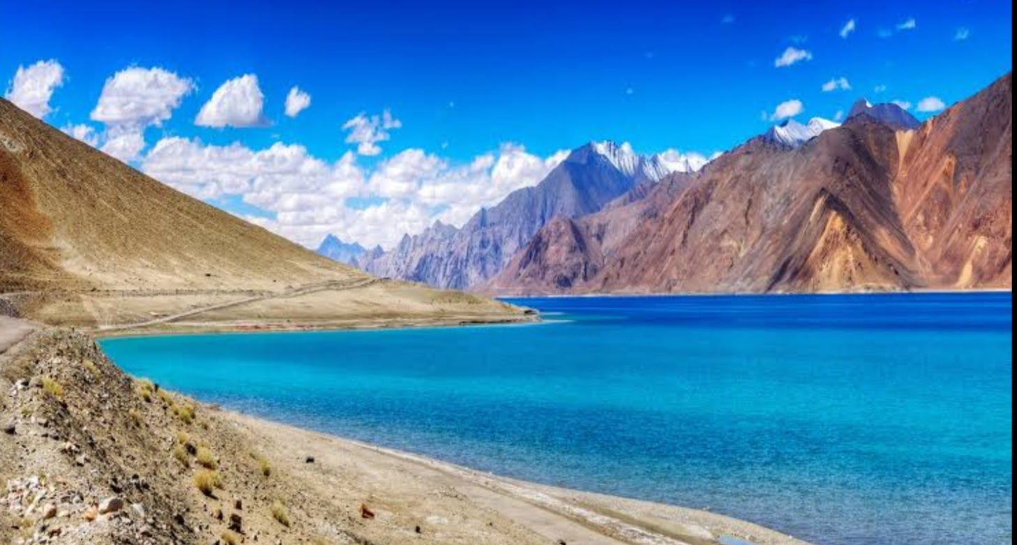
The Leh Valley lies at an altitude of about 3,500 metres and the surrounding mountains rise to over 6,000 metres. The area is remote: the main road linking Ladakh with the rest of India is cut off by snow for six months or more each year. This is a high-altitude desert environment where water is precious. Agriculture and human settlements depend on water from snow melt, which flows towards the Indus River.
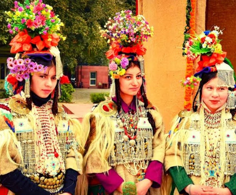
Traditionally, most Ladakhis were subsistence farmers growing mainly barley and vegetables, or they were nomads tending goats and yaks.
History Of Ladakh
Leh (Ladakh) was known in the past by different names. It was called Maryul or low land by some Kha- chumpa by others. Fa-Hein referred to it as Kia-Chha and Hiuen Tsang as Ma-Lo-Pho. It is said that the first Immigrants to this land appears to have been the Brokpas from Dadarstan who inhabited the lower reaches of the Indus Valley popularly known as Sham. The ancient inhabitants of Ladakh were Dards, an Indo- Aryan race. Immigrants of Tibet, Skardo and nearby parts like Purang, Guge settled in Ladakh, whose racial characters and cultures were in consonance with early settlers. Buddhism traveled from central India to Tibet via Ladakh leaving its imprint in Ladakh. Islamic missionaries also made a peaceful penetration of Islam in the early 16th century. German Moravian Missionaries having cognizance of East India Company also made inroads towards conversion but with little success.King Singge Namgyal had consolidated the Ladakhi Empire into a strong kingdom. He was not only a strong monarch but a statesman, a diplomat and a builder. He built the historic 9- storeyed Leh palace and made the other neighboring countries envy of such an elegant palace. He also promoted horse polo in Ladakh.
In the ancient times the present Leh district was a part of Greater Ladakh spread over from Kailash Mansarover to Swaat (Dardistan). The Greater Ladakh was neither under the Domain of Tibet or its influence. Not much information is available about the ancient History of Ladakh. However, reference about the place and its neighbourhood in Arab, Chinese and Mongolian histories gives an idea that in the 7th Century A.D fierce wars were fought by Tibet and China in Baltistan area of the Greater Ladakh in which deserts and barren mountains of Ladakh was tuIn the post-partition scenario, Pakistan and China illegally occupied 78,114 sq. km and 37,555 sq.km of the state, respectively while the remaining part of the state acceded to India. Pakistan also illegally gifted 5180 sq.kms of this area to China. Ladakh, comprising the areas of present Leh and Kargil districts, became one of the seven districts of the State. In 1979 when the reorganization of the districts was carried out, the Ladakh district was divided into two full fledged district of Leh and Kargil into battle fields for the warring armies.
Religious beliefs
With the rise of Islamic States, areas close to Kashmir was influenced by Islam. So the major religion of Ladakh is Budhism and more than 77% population of Ladakh is Bhddhist followed by Muslim population around 14%. Prior to Islam, Hinduism dominated Kashmir and there are 8% Hindus too in Ladakh.
Ladakh ReligionThe Tibetan influence in Ladakh is manifest: all religious books and prayers are in the Tibetan language, the monastic orders in the gompas are those developed in Tibet and the gompa artwork is clearly Tibetan in origin. Even the architectural design of Leh Palace is very similar to that of Lhasa's Potala Palace. Tibetan Buddhism is built on an earlier Tibetan religion - Bon or Bon-Shamanism - and it incorporated many of Bon's demons and gods. It similarly incorporated many of the gods in the Hindu pantheon, transforming them into Bodhisattavas or different incarnations or manifestations of various personalities.
The walls of Ladakh's gompas are covered with illustrations of the Lord Buddha, his manifestations and followers, and the incorporated Bon and Hindu guardian deities in their various incarnations. It all makes for colourful and varied wall murals in every Ladakh gompa.
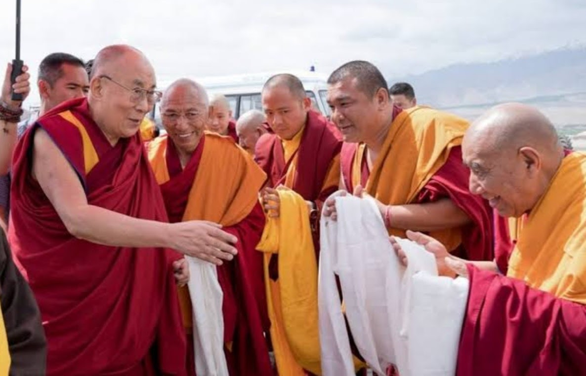
The monasteries follow each of the two main sects of Buddhism that developed in Tibet: the Karyu pa or red-hat sect and the Gelug pa or yellow-hat sect. The Dalai Lama, believed to be a reincarnation of the Boddhisattva Avalokitesvara, is the head of the Gelug-pa sect.
The gompas represent the monastic side of Buddhism, or lamaism. The lamaist side of Buddhism, requiring lon tation, contrasts with the everyday practice of Buddhism by Ladakhi lay people.
For Ladakhis, religion is a daily affair with visible rituals that are frequently observed. These include spinning prayer wheels, making pilgrimages to gompas, chortens, mani walls and holy tombs, chanting mantras and reciting prayers in the area of the home set aside as a chapel.
Tourism in Ladakh
Tourism is one of an economic contributor to the union territory of Ladakh in Northern India. The union territory is part of the broader disputed Kashmir region and is sandwiched between the Karakoram mountain range to the north and the Himalayas to the south and is situated at the height of 11,400 ft. Ladakh is composed of the Leh and Kargil districts. The region contains prominent Buddhist sites and has an ecotourism industry. As of 2020, tourism industry in Ladakh was worth ₹600 crore (US$84 million)
Tourist places
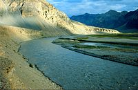
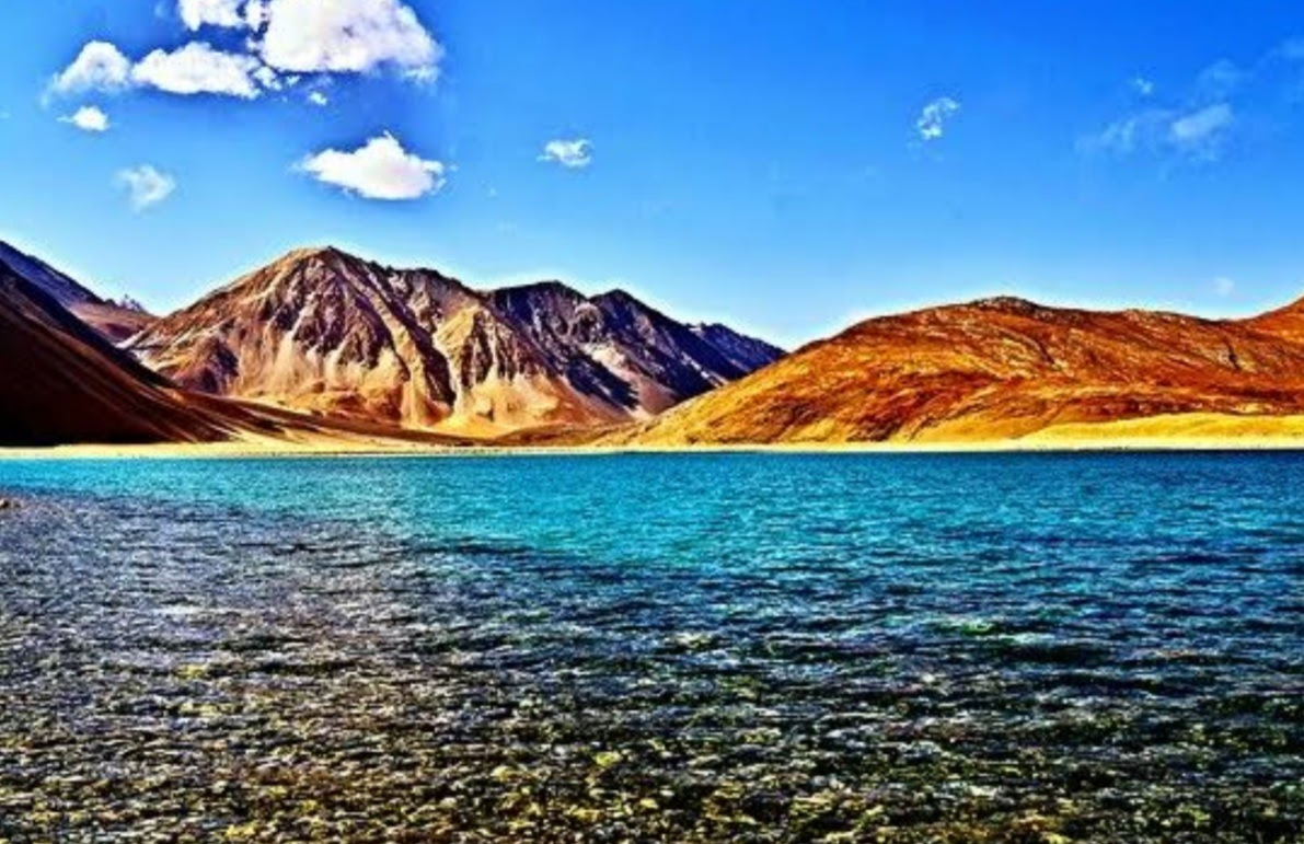
Among the places of tourist interest include Leh, Drass valley, Razi khar (Chiktan Khar), Suru valley, Kargil, Zangskar, Zangla, Rangdum, Padum, Phukthal, Sani Monastery, Stongdey, Shayok Valley, Sankoo, Salt Valley. Treks include Manali to Ladakh, the Nubra valley, Pangong tso, Tso moriri, the Indus valley, Markha valley, Ladakh monastery trek, South Zangskar, Trans-Zangskar Expedition, Spiti to Ladakh, Spiti to Pitok to Hemis, Rupshu, the Great Salt lakes, Chadar Ice trek, Padum-Phuktal, Padam to Darcha, Panikhar to Heniskot, Padum to Manali, Lamayuru-Martselang, Lamayuru - Alchi, Kala Pattar trek, Pahal
Other Locations
The Razi Khar (Chiktan kahr/Chiktan Palace), which is situated 76 km from Kargil and 180 km from Leh is situated on the highway from Kargil to Leh, and is the first Palace of the then ruler Thatha Khan.
The Leh Palace, which is situated behind the main market has eight stories and is similar to the Potala Palace of Lhasa and still belongs to the royal family of Ladakh. Just ahead of the palace is the Chamba Temple, which is a one roomed shrine that has a large icon of Maitreya, the Buddha to come.
Also in the bazaar, at the top of the street, one can see the Jama Masjid. This has been painted in green and white colour. Another place to visit is the Sankar Gompa, which is situated in the city and is one of the oldest structures here. At one time, this monastery only welcomes a maximum of twenty monks.
The Thikse Monastery is the largest monastery in central Ladakh and is primarily known for its statue of Maitreya in its Maitreya Temple. This statue is 15 m (49 ft) high and the largest such statue in Ladakh. The Buddha is unusually portrayed as seated in the lotus position rather than his usual representations as standing or in a sitting posture on a high throne.
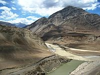
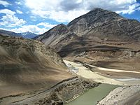
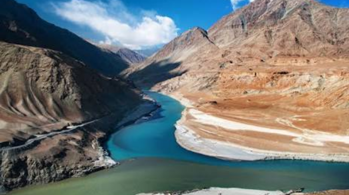
Zanskar and Indus river confluence, in Ladakh
About 65 km west of Leh, towards Zanskar river, is the village of Sumda Chun at height of 3500 mtr. The monastery of Sumda-Chun is one of the most important surviving early Tibetan Buddhist temples of the Ladakh region
Geographical Conditions
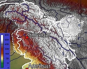
Ladakh is the highest plateau in India with much of it being over 3,000 m (9,800 ft). It extends from the Himalayan to the Kunlun Ranges and includes the upper Indus River valley.
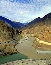
The confluence of the Indus (green water to the left) and Zanskar (brown water to the right) rivers.
The Ladakh region has high altitude
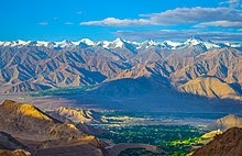
View of Leh Town Along with Stok Kangri
Historically, the region included the Baltistan (Baltiyul) valleys (now mostly in Pakistani administered part of Kashmir), the entire upper Indus Valley, the remote Zanskar, Lahaul and Spiti to the south, much of Ngari including the Rudok region and Guge in the east, Aksai Chin in the northeast, and the Nubra Valley to the north over Khardong La in the Ladakh Range. Contemporary Ladakh borders Tibet to the east, the Lahaul and Spiti regions to the south, the Vale of Kashmir, Jammu and Baltiyul regions to the west, and the southwest corner of Xinjiang across the Karakoram Pass in the far north. The historic but imprecise divide between Ladakh and the Tibetan Plateau commences in the north in the intricate maze of ridges east of Rudok including Aling Kangri and Mavang Kangri, and continues southeastward toward northwestern Nepal. Before partition, Baltistan, now under Pakistani control, was a district in Ladakh. Skardo was the winter capital of Ladakh while Leh was the summer capital.
The mountain ranges in this region were formed over 45 million years by the folding of the Indian Plate into the more stationary Eurasian Plate. The drift continues, causing frequent earthquakes in the Himalayan region.[c][59] The peaks in the Ladakh Range are at a medium altitude close to the Zoji-la (5,000–5,500 m or 16,400–18,000 ft) and increase toward southeast, culminating in the twin summits of Nun-Kun (7,000 m or 23,000 ft).
The Indus River is the backbone of Ladakh. Most major historical and current towns – Shey, Leh, Basgo and Tingmosgang (but not Kargil), are close to the Indus River. After the Indo-Pakistani War of 1947, the stretch of the Indus flowing through Ladakh became the only part of this river, which is greatly venerated in the Hindu religion and culture, that still flows through India.
The Siachen Glacier is in the eastern Karakoram Range in the Himalaya Mountains along the disputed India-Pakistan border. The Karakoram Range forms a great watershed that separates China from the Indian subcontinent and is sometimes called the "Third Pole." The glacier lies between the Saltoro Ridge immediately to the west and the main Karakoram Range to the east. At 76 km (47 mi) long, it is the longest glacier in the Karakoram and second-longest in the world's non-polar areas. It falls from an altitude of 5,753 m (18,875 ft) above sea level at its source at Indira Col on the China border down to 3,620 m (11,880 ft) at its snout. Saser Kangri is the highest peak in the Saser Muztagh, the easternmost subrange of the Karakoram Range in India, Saser Kangri I having an altitude of 7,672 m (25,171 ft).
The Ladakh Range has no major peaks; its average height is a little less than 6,000 m (20,000 ft), and few of its passes are less than 5,000 m (16,000 ft). The Pangong range runs parallel to the Ladakh Range for about 100 km (62 mi) northwest from Chushul along the southern shore of the Pangong Lake. Its highest point is about 6,700 m (22,000 ft) and the northern slopes are heavily glaciated. The region comprising the valley of the Shayok and Nubra rivers is known as Nubra. The Karakoram Range in Ladakh is not as mighty as in Baltistan. The massifs to the north and east of the Nubra–Siachen line include the Apsarasas Group (highest point at 7,245 m or 23,770 ft) the Rimo Muztagh (highest point at 7,385 m or 24,229 ft) and the Teram Kangri Group (highest point at 7,464 m or 24,488 ft) together with Mamostong Kangri (7,526 m or 24,692 ft) and Singhi Kangri (7,202 m or 23,629 ft). North of the Karakoram lies the Kunlun. Thus, between Leh and eastern Central Asia there is a triple barrier – the Ladakh Range, Karakoram Range, and Kunlun. Nevertheless, a major trade route was established between Leh and Yarkand.
How Ladakh Became a Union Territory
Some activists from Leh in recent times called for Ladakh to be constituted as a union territory because of perceived unfair treatment by Kashmir and Ladakh's cultural differences with predominantly Muslim Kashmir valley, while some people in Kargil opposed union territory status for Ladakh.
The eastern end, consisting of the uninhabited Aksai Chin plains, is claimed by the Indian Government as part of Ladakh, and has been under Chinese control since 1962... In August 2019, the Parliament of India passed an act by which Ladakh became a union territory on 31 October 2019.
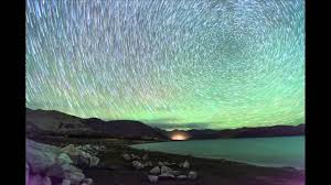
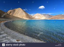
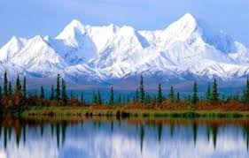
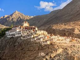
Ladakh Gallery
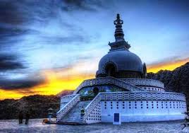
Amazing!!!!
ReplyDeleteThank you but Who are you
DeleteToo gud 👌👌
ReplyDeleteThank you vaise aap kaun
DeleteHarshika
Deleteoh Thank you
DeleteThank you Nandani
ReplyDeleteNice place
ReplyDelete